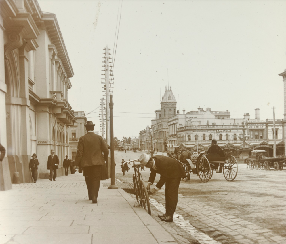
Ballarat’s landscape formed 500 million years ago. Through a series of dramatic changes caused by tectonic forces, erosion, volcanic activity, climatic change and water flows, Ballarat’s alluvial and deep lead gold deposits were formed. Today, Ballarat sits within a distinctive setting. Central Ballarat is characterised by its strong grid pattern over a bluestone plateau overlooking Ballarat East with its irregular layout, and the important cultural and visual landmarks of Mt Warrenheip, Mt Buninyong and the forested ridges that help frame the city.
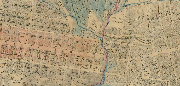
Ballarat and Ballarat East historic map. Public Record Office Victoria
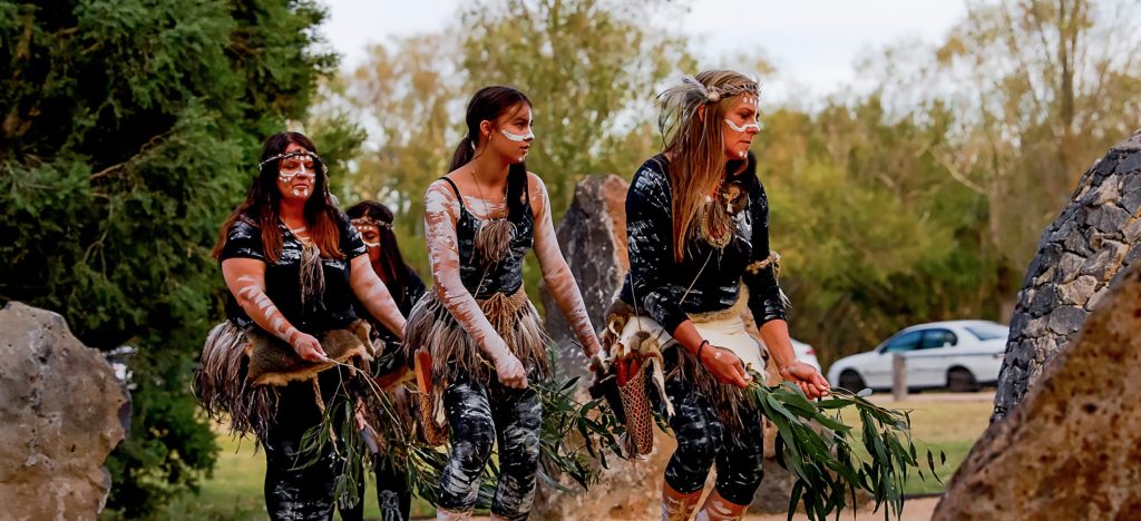
The municipality extends across parts of the Traditional Country of the Wadawurrung and Dja Dja Wurrung peoples, who have lived here for at least 50,000 years and remain connected to these landscapes. Their ancestors shaped the landscape through their activities, knowing it deeply and imbuing it with important cultural and spiritual meanings.
Ballarat is thought to be named from two Aboriginal words: ‘balla’ meaning elbow or reclining on the elbow, and ‘arat’, meaning place. The whole Country embodies songlines and storylines that connect Wadawurrung and Dja Dja Wurrung people to places. Places where Wadawurrung and Dja Dja Wurrung old people lived and contemporaries are still living today. Places for hunting, fishing and harvesting. Places that witnessed large gatherings, as well as spiritual and ceremonial locations. Through their cultural practices, stories and traditions, knowledge was built and shared, generation by generation and continues to be today. Significant landscape changes were witnessed too. Wadawurrung stories tell of volcanic eruptions and floods – the rising levels of the seas. Displacement and loss is also part of the story for Wadawurrung and Dja Dja Wurrung peoples, and the landscape once named by them has now been overlain with other names.
Ballarat has become home to people from many Aboriginal and Torres Strait Islander groups throughout Australia and remains part of the Kulin Nation, an alliance of five Aboriginal nations in central Victoria that have similarities in language, custom and tradition. Their collective territories extend from around Port Phillip and Western Port, up into the Great Dividing Range and the Loddon and Goulburn River Valleys.
The occupation of Country by settler peoples also brought significant change. The landscape today is dotted with farms, small settlements and towns that reflect these migrant cultures, primarily derived from the UK (English, Irish, Scottish, Welsh and Cornish), North America, continental Europe and China. But many of the best places to live and the easiest routes to travel reflect both Aboriginal and settler peoples’ movement patterns.
Occupation of Aboriginal peoples’ traditional lands began with graziers bringing in their stock and finding ideal pasture, water and house sites. The discovery of gold quickly attracted other migrants from near and far, who set up transient mining camps and reshaped parts of the landscape – extracting heavily from it. Aboriginal people played a key role in the economy of this period by providing miners with food, shelter, clothing and local knowledge, including in some instances, the actual locations to find gold. They were and continue to be part of the social, cultural and economic fabric of Ballarat.
Murrup Laarr by Yum Studio
The initial focus of the gold rushes was Buninyong. The town of Buninyong had been established prior to the discovery of gold and the rush to the town in August 1851 preceded the much larger discoveries in Ballarat soon after. Buninyong ultimately became better known for the deep lead workings of the Buninyong Company. By 1888 it was still quite prosperous with a number of reef mines and the Main Lead still operating.
Throughout the 1850s miners underwent many hardships, but one of the most disliked was the government gold licence, which cost hard earned money simply to be allowed to explore. The story of the Eureka Stockade is well known as the reaction to this taxation impost.
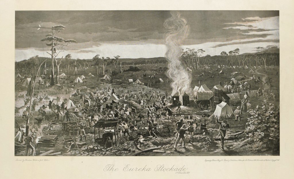
The Eureka Stockade 1854 – Patterson, Shugge & Co. State Library Victoria